Garmin Topoactive Maps

In case any of you are Garmin users, (watches, cycle computers etc) I have found using Garmin connect website helpful in some instances where you just cant be quite sure of if a route "works".
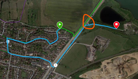
You can create a route using "training/courses" from the menu, much like making a route on OS, but if you allow it to use " popularity routing" it will automatically default to where people have actually been using a trail. Just put a start point somewhere before you need the info, create a "course" (I usually set to trail running or hiking) then click on the map somewhere beyond your queried route. It will default to the most used trail. I found that this shows up a possible route error, for example where OS map shows a footpath going up to a stream or dual carriageway, and apparently continuing the other side. But does it go through a tunnel/is a the bridge useable etc? If not in use the Garmin course will take a diversion
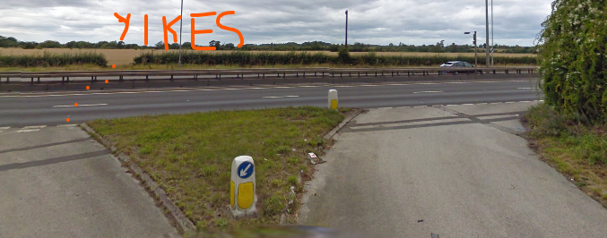
In my eg below, I thought from the OS map that the footpath crossed underneath the A road, but on checking the Garmin course, it looks like not! I did try to assess on street view also but not entirely clear. Based on the Garmin info I have re-routed the entire Slow Way as it looks like a very unsafe place to cross!

-

Yikes indeed!
This is really useful, thank you for sharing Carole.
0 -

I suspect the highway contractor (or authority) could be instructed to make good the ROW. (Just as a farmer is can theoretically required to either 'not plough the ROW' or 'make good' after ploughing a field crossed by a ROW).
Not sure if this project wants to get distracted by issues with particular ROWs, but maybe a note to the council official responsible for ROWs?
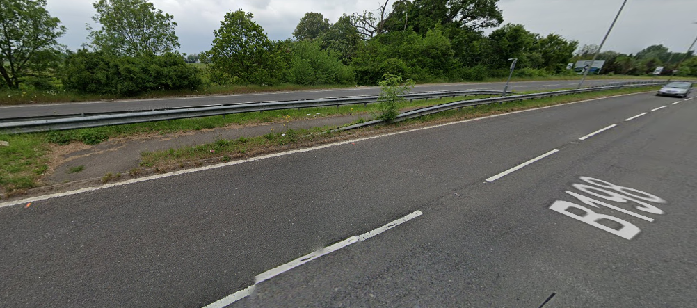
Compare with the shot below, where a crossing is provided for the ROW.(I put a comment nearby at TL 3499 0114 , as a safer detour is available)
on https://osmaps.ordnancesurvey.co.uk/route/4852010/Brentwood-Chipping-Ongar-Chibre-Slow-Ways
Matt Moore
0 -

Strava heatmap would offer a similar alternative, not so interactive but you can see which routes have been used more. Thanks for the reminder - I can at least see that a footpath I was unsure about yesterday (no clear fingerpost/hedge gap on Streetview) seems to have been used.
https://www.strava.com/heatmap#6.82/-4.74673/52.87470/hot/all
You need a Strava account to zoom right in, but it's free to sign up.
0 -
Yes, all of these are useful if there is any doubt about usability of a route. Can save a lot of legwork...
0
Please sign in to leave a comment.
Comments
4 comments